Access Across America: Biking 2019 Accessibility Maps (Medium-Stress Routes)
The following maps show summary accessibility data and maps for each of the metropolitan areas included in the study.
The maps show 30-minute accessibility values at the Census block level. Lighter colors indicate few jobs can be reached within 30 minutes; darker colors indicate more jobs can be reached within 30 minutes. At the highest levels, more than 100,000 jobs are accessible by bike within 30 minutes.
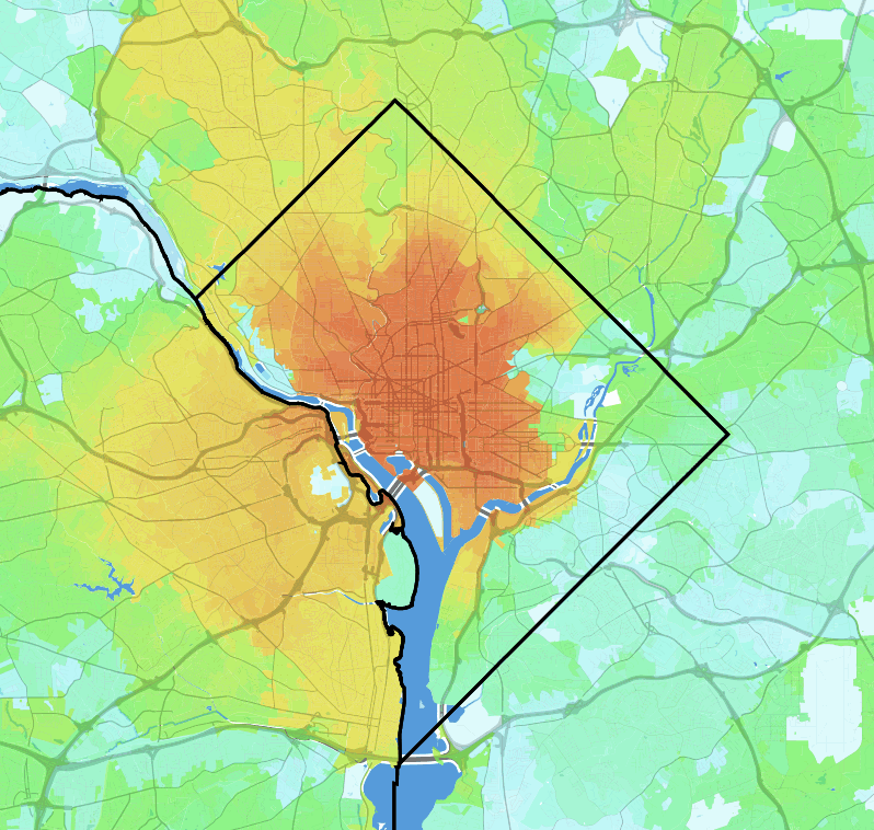
Accessibility map of Washington, DC
- New York
- San Francisco
- Chicago
- Los Angeles
- Denver
- Boston
- Seattle
- Portland
- San Jose
- Minneapolis
- Washington
- Philadelphia
- Salt Lake City
- Columbus
- Las Vegas
- Miami
- Phoenix
- Austin
- Buffalo
- Baltimore
- Milwaukee
- New Orleans
- Tampa
- Detroit
- Cincinnati
- San Diego
- Cleveland
- Pittsburgh
- Sacramento
- Dallas
- Kansas City
- Orlando
- Richmond
- Louisville
- Indianapolis
- Charlotte
- Houston
- St. Louis
- Atlanta
- Raleigh
- Hartford
- San Antonio
- Providence
- Oklahoma City
- Jacksonville
- Nashville
- Riverside
- Virginia Beach
- Birmingham
- Memphis